San Vicente Redwoods

Restoring the Land for Recreation and Long-Term Resilience
San Vicente Redwoods was envisioned by four conservation partners motivated to protect the region’s delicate and diverse ecosystems and connect people with nature, yet when the 8,852 acre land was ravaged by wildfire, it presented a new opportunity to witness first-hand the impact of the climate crisis as well as nature’s resilient response.
The largest privately owned parcel in Santa Cruz County, the San Vicente Redwoods property presented a powerful opportunity to reverse more than a century of destructive commercial logging and cement manufacturing practices in a unique restoration project. In 2011, four conservation partners – the Land Trust of Santa Cruz County, Peninsula Open Space Trust, Sempervirens Fund and Save the Redwoods League – formed a collective that acquired the property and committed to its permanent protection. This partnership would merge conservation and recreation, prioritizing wildlife habitats, forest restoration, watershed protection, and public access. Sustainable timber harvesting on a portion of the property would also create revenue to fund long-term conservation.
The Land Trust of Santa Cruz County embraced the role of Public Access Manager, overseeing community engagement, design and planning, fundraising, trail construction, and operations and maintenance. The Land Trust hired Sherwood Design Engineers, Placeworks, WRA Environmental Consultants, and Santa Cruz Mountain Trail Stewards to participate in bringing this project to life, following a highly collaborative and efficient design-build approach that ultimately saved the investment partners time and money.
Prioritizing conservation, Sherwood’s team identified the locations of wildlife habitats and corridors and other important natural resources and set them aside. Then, trail alignments were proposed on the remaining property, first using Geographic Information System (GIS) software, followed by weeks in the field to refine the trail layout. With a consideration to slopes, creeks and natural drainage, the trail corridor was marked with flagging. This iterative onsite effort would ensure that the trails are light on the delicate landscape but still appealing to trail users by including a rock garden section and gravity flow elements as well as visually interesting alignments and ocean-view vista points.
Public accessibility and connectivity with the land and its history were additional project drivers, and the Amah Mutsun Tribal Band are among the groups collaborating in its ongoing care. Each of the trails is named in the indigenous Awaswas language to honor the people who inhabited the land and served as its stewards for millennia. The multi-use trails also include a ¾-mile Outdoor Recreation Access Route, or ORAR trail, which offers trail users of all abilities gentle grades, wider trail width, and durable trail tread to a beautiful vista point. Phase-one included the development of a new trailhead – including a smart kiosk for trail access passes, restrooms, picnic benches, congregation area, fire-water storage tanks, and a parking lot that features natural passive stormwater management.
The nearly 9,000-acre property serves as critical habitat for many regionally significant species, including endangered Coho salmon, marbled murrelet, pumas, and peregrine falcons; old growth redwood and oak woodlands; and stands of threatened manzanita shrubs. It’s also the home range and denning area for mountain lions. The trail network was designed to avoid all of these natural resources. When all three phases and 38 miles of trails are complete, they’ll connect to adjacent conservation areas, such as the Cotoni-Coast Dairies National Monument, not only giving the public rare access from the ridgeline to the coastline but also creating vital permanent wildlife corridors.
Creeks and natural drainage patterns were also considered as Sherwood’s team closely evaluated more than 100 locations where the trails would cross drainages of varying significance. In each instance, designers determined whether the crossing could be avoided, and if it couldn’t, the team considered what would be the best and most sustainable way to cross in order to protect and preserve the natural flow. This approach resulted in three new bridges in phase one and sixteen upon full build-out.
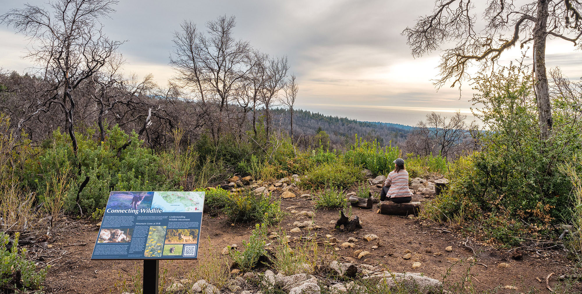
And then came fire. The CZU Lightning Complex Fires of August 2020 not only destroyed massive swaths of the forested land, requiring more than 1,000 damaged and now-hazardous trees to be removed from the site, it also wiped out the trail flags. Fortunately, sustainability had been prioritized from the start and the trails did not require a redesign after the fire, but they did have to be re-flagged as the team assessed the way fire changed the landscape and the ecology. Water flow, for example, shifts constantly as it adjusts naturally to forest debris like logs and branches. After the fire, Sherwood had to reevaluate drainage patterns and once again ensure each water crossing remained sustainable. Another shift was the clearance that had been planned around critical habitats that had been carefully mapped as the trails were designed. When the fire destroyed those habitats the clearance requirements changed, but a new responsibility emerged to monitor where new habitats would be created in the future.
The first phase of multi-use trails, which opened in 2023, gives visitors a front-row seat to witness nature’s response to fire. The scarred land and its continuous renewal serves as a reminder of the powerful impact of climate change, and of the important role that communities play in the stewardship of natural resources.
The Land Trust secured funding for the project with over $3 million in private donations and $5 million in grants from the California State Coastal Conservancy, the Wildlife Conservation Board, and the California Natural Resources Agency. The design-build contractor, Santa Cruz Mountain Trail Stewards, has also relied on local volunteers to assist in several construction and installation efforts, creating civic pride and shared ownership within the community. With conservation and connection as guiding principles, the alliance of like-minded partners has successfully turned a misused industrial property into a prized community asset for individuals and families to enjoy for generations.